



Metro+ (Madrid subway, buses)

คำอธิบายของMetro+ (Madrid subway, buses)
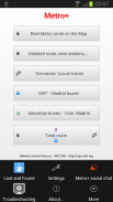
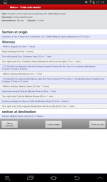
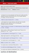
The most powerful app for finding the best route in Madrid (now also best Metro routes for several cities). Metro+ will make it easy for you: Metro Madrid, bus networks,.... Metro+ offers excelent information so that you cannot get lost. Besides, the "Total route" option collects all public transport obtaining the best itineray, even with walking instructions. You will be always supported by text and maps with a very user-friendly interface and providing the best user experience. Always up-2-date with downloadable DBs.
The main features are:
- Metro (several cities):
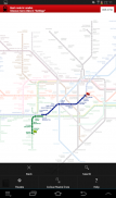
. Fast math calculations in order to find the best route between 2 stations. You can choose among several Metro networks: Madrid, Barcelona, New York, London, Paris, Rome, etc.... "Metro+" shows you the aprox. time to complete the route. Nearest Metro station search (not for all Metro maps).
The best route is calculated on the Metro plan tapping both stations (start and destination) or selecting them from the menu "Route". This section has got its own favourites and the best route can also be viewed on a list.
This option does not requiere Internet.
- Metro de Madrid:
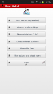
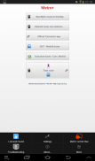
. Best route within the Metro de Madrid network. Just select start and end station, time and date (optional) and Metro+ will provide the best itineray. You can add favourites and widgets.
. Network status (+widget), disruptions and news
. 1 way fare
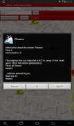
. Map that shows your location and all Metro de Madrid stations. Tapping one station, Metro+ shows you the distance between you and the selected station plus extra information, like pictures, etc... You can also enter a postal address or POI and the distance would be calculated between this entered location and the station. Optional: Metro+ can alert you with notifications of proximity alerts using vibration, LED and text notification when you approach the station (100 m.) or go away from this radious.
. List of stations in 10 km. radious from your location. You can tap a Metro station for more info.
. List of all Metro lines (including Metro Ligero and Metro Sur). Tap a station for info.
. Fares
. Official maps
- Widgets: best route & lines status
- Cercanías (local trains):
. Official Renfe Cercanías app built-in in Metro+: timetable, best route, disruptions, news... (for Madrid and other spanish cities).
- Madrid EMT buses:
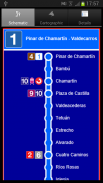
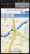
. List of all EMT lines, schematic departure & return maps with itinerary and timetable. Also the paths on a Google map
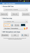
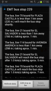
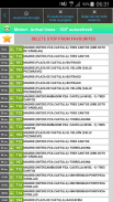
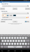
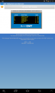
. Waiting times: Provided in real time for all the bus stops (thousands). Just enter the code/number stop and Metro+ will indicate what (line and destination) bus is next that is approaching. You can add favourites, view the picture of the stop, etc... Also you can see the selected stop on a map with traffic status. If you tap on the bus icon, Metro+ shows you the distance between you and the stop. If you enter a postal address or POI, the distance will be between this location and the stop. Optional: Notification of proximity alert when approaching the selected bus stop (100 m).
. EMT disruptions.
- Widget: waiting times for all stops.
. List that shows the nearest bus stops from your location (3 km.) + info of every stop.
. Map & all bus stops + info.
- Urban buses (with next arrival times and also widget) of localities within the "Comunidad de Madrid" like Móstoles, Alcorcón, Fuenlabrada, Alcobendas, etc...
- Suburban buses:
. All lines & maps, itinerary and timetable.
. Complete Info of every line.
. Next arrival times (also widget)
. Disruptions.
- Total route:
. Best route between two locations taking into account different public transports, waking, etc. You can add favourites and widgets from here. Also you can check the route on a map. Total route is the ultimate way to get the best and fastest route.
- Widget
- Map with bicycle lanes in Madrid.
- Spanish & English.
- Link to "Metro+" chat (Social network & Community for "Metro+" users).
- Lost and Found section
app ที่มีประสิทธิภาพมากที่สุดในการหาเส้นทางที่ดีที่สุดในกรุงมาดริด (ตอนนี้ยังดีที่สุดสำหรับเส้นทางรถไฟใต้ดินหลายเมือง) Metro + จะทำให้มันง่ายสำหรับคุณ: เมโทรมาดริดเครือข่ายรถบัส, .... Metro + เสนอข้อมูลที่ดีเยี่ยมเพื่อให้คุณไม่สามารถได้รับหายไป นอกจากนี้ "เส้นทางรวมตัวเลือก" รวบรวมการขนส่งสาธารณะทั้งหมดได้รับ itineray ที่ดีที่สุดแม้จะมีคำแนะนำการเดิน คุณจะได้รับการสนับสนุนเสมอโดยข้อความและแผนที่ที่มีอินเตอร์เฟซที่ใช้งานง่ายมากและให้ประสบการณ์การใช้งานที่ดีที่สุด เสมอ up-2-date กับดีบีเอสดาวน์โหลด
คุณสมบัติหลักคือ:
- รถไฟฟ้าใต้ดิน (หลายเมือง):
. การคำนวณทางคณิตศาสตร์ได้อย่างรวดเร็วเพื่อหาเส้นทางที่ดีที่สุดระหว่าง 2 สถานี คุณสามารถเลือกระหว่างเครือข่ายรถไฟใต้ดินหลายมาดริด, บาร์เซโลนา, นิวยอร์ก, ลอนดอน, ปารีส, โรม ฯลฯ .... "เมโทร +" แสดงให้คุณเห็น aprox เวลาที่จะเสร็จสมบูรณ์เส้นทาง ที่ใกล้ที่สุดเมโทรค้นหาสถานี (ไม่ได้สำหรับทุกเมโทรแผนที่)
เส้นทางที่ดีที่สุดที่มีการคำนวณในแผนเมโทรแตะทั้งสองสถานี (เริ่มต้นและปลายทาง) หรือเลือกจากเมนู "เส้นทาง" ในส่วนนี้จะได้มีรายการโปรดของตัวเองและเส้นทางที่ดีที่สุดนอกจากนี้ยังสามารถดูได้ในรายการ
ตัวเลือกนี้ไม่ requiere อินเทอร์เน็ต
- เมโทรมาดริด:
. เส้นทางที่ดีที่สุดภายในเครือข่ายเมโทรมาดริด เพียงแค่เลือกเริ่มต้นและสิ้นสุดที่สถานี, เวลาและวันที่ (ถ้ามี) และรถไฟใต้ดิน + จะให้ itineray ที่ดีที่สุด คุณสามารถเพิ่มรายการโปรดและเครื่องมือ
. สถานะเครือข่าย (เครื่องมือ +), การหยุดชะงักและข่าว
. 1 ค่าโดยสาร
. แผนที่ที่แสดงให้เห็นตำแหน่งของคุณและสถานีรถไฟฟ้าใต้ดินมาดริด แตะหนึ่งในสถานีรถไฟใต้ดิน + แสดงให้คุณเห็นระยะห่างระหว่างคุณและสถานีที่เลือกบวกข้อมูลเพิ่มเติมเช่นภาพ ฯลฯ ... นอกจากนี้คุณยังสามารถป้อนที่อยู่ไปรษณีย์หรือจุดที่น่าสนใจและระยะทางที่จะได้รับการคำนวณระหว่างนี้เข้ามาในสถานที่และสถานี ตัวเลือก: Metro + สามารถแจ้งเตือนคุณด้วยการแจ้งเตือนของการแจ้งเตือนความใกล้ชิดโดยใช้การสั่นสะเทือนและการแจ้งเตือน LED ข้อความเมื่อคุณเข้าใกล้สถานีหรือไปจาก radious นี้ (100 ม.)
. รายการของสถานีใน 10 กิโลเมตร radious จากสถานที่ของคุณ คุณสามารถแตะที่สถานีรถไฟใต้ดินเพื่อดูข้อมูลเพิ่มเติม
. รายชื่อของรถไฟใต้ดิน (รวมทั้งรถไฟฟ้าและรถไฟใต้ดิน Ligero Sur) แตะสถานีข้อมูล
. ค่าโดยสาร
. แผนที่อย่างเป็นทางการ
- วิดเจ็ต: เส้นทางที่ดีที่สุดและสถานะสาย
- Cercanías (รถไฟท้องถิ่น):
. อย่างเป็นทางการ Renfe Cercaníasการตรวจสอบในตัวใน Metro + ตารางเวลาเส้นทางที่ดีที่สุดการหยุดชะงักข่าว ... (สำหรับมาดริดและเมืองสเปนอื่น ๆ )
- รถบัสมาดริด EMT:
. รายชื่อของสาย EMT ทั้งหมดเดินทางกลับวงจรและแผนที่ที่มีรายละเอียดการเดินทางและตารางเวลา นอกจากนี้ยังมีเส้นทางบนแผนที่ของ Google
. รอเวลา: ติดมาให้ในเวลาจริงสำหรับทุกรถบัสหยุด (พันบาท) เพียงแค่ใส่รหัส / หยุดจำนวนและ Metro + จะแสดงสิ่งที่ (สายและปลายทาง) รถบัสต่อไปที่กำลังใกล้เข้ามา คุณสามารถเพิ่มรายการโปรดดูภาพของการหยุด ฯลฯ ... นอกจากนี้คุณสามารถดูหยุดที่เลือกบนแผนที่ที่มีสถานะการจราจร หากคุณแตะที่ไอคอนรถบัสรถไฟใต้ดิน + แสดงให้คุณเห็นระยะห่างระหว่างคุณและหยุด หากคุณป้อนที่อยู่ไปรษณีย์หรือจุดที่น่าสนใจระยะทางจะอยู่ระหว่างสถานที่นี้และหยุด ตัวเลือก: ประกาศแจ้งเตือนความใกล้ชิดเมื่อใกล้ป้ายรถเมล์ที่เลือก (100 เมตร)
. การหยุดชะงักกู้ภัย
- Widget: เวลารอให้หยุดทั้งหมด
. รายชื่อที่แสดงให้เห็นรถเมล์ที่ใกล้ที่สุดหยุดจากสถานที่ (3 กม.) + ข้อมูลหยุดทุก
. แผนที่และรถบัสหยุด + ข้อมูล
- รถบัสเมือง (ที่มีเวลามาถึงต่อไปและเครื่องมือ) ของท้องถิ่นอยู่ใน "Comunidad มาดริด" ชอบMóstoles, Alcorcon, Fuenlabrada, Alcobendas ฯลฯ ...
- รถบัสชานเมือง:
. ทุกสายและแผนที่การเดินทางและตารางเวลา
. ข้อมูลที่สมบูรณ์ของทุกบรรทัด
. ครั้งถึงถัดไป (หรือเครื่องมือ)
. การหยุดชะงัก
- เส้นทางทั้งหมด:
. เส้นทางที่ดีที่สุดระหว่างสองสถานที่คำนึงถึงความแตกต่างกันระบบขนส่งมวลชนตื่น ฯลฯ คุณสามารถเพิ่มรายการโปรดและเครื่องมือจากที่นี่ นอกจากนี้คุณสามารถตรวจสอบเส้นทางบนแผนที่ เส้นทางรวมเป็นวิธีที่ดีที่สุดที่จะได้รับเส้นทางที่ดีที่สุดและเร็วที่สุด
- Widget
- แผนที่ที่มีเลนจักรยานในกรุงมาดริด
- ภาษาสเปนและภาษาอังกฤษ
- เชื่อมโยงไปยัง "เมโทร +" แชท (เครือข่ายสังคมและชุมชน "เมโทร +" ผู้ใช้)
- ส่วนที่หายไปและพบ


